British Admiralty charts – Mediterranean Sea, West part 35 charts among which 6 provisional WWII charts
Lotto 621bis
1 0002 000
Comprising:
Mediteranean Sea – Gibraltar (issue 1953, edition1965),
Mediterranean – Marseille (issue 1909, edition 1913),
Mediterranean - Sardinia, S. Portion(issue 1874, edition 1885),
Mediterranean - Sardinia, N Portion(issue 1874, edition 1915),
Sicily, Golfo di Palermo (issue 1877, edition 1914),
Sicily, sheet 1, Cefalu to Mazara (issue 1876, edition 1930),
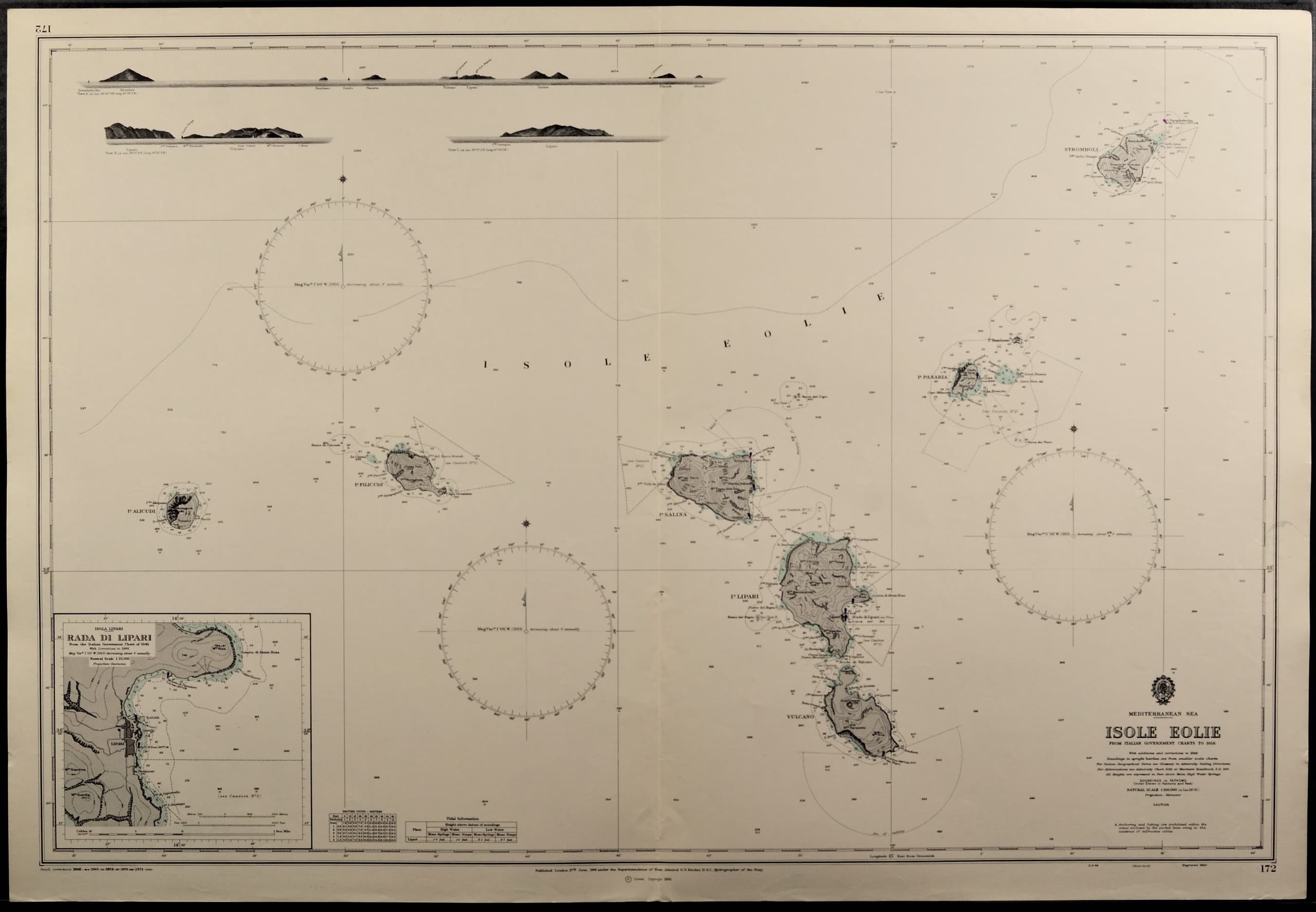
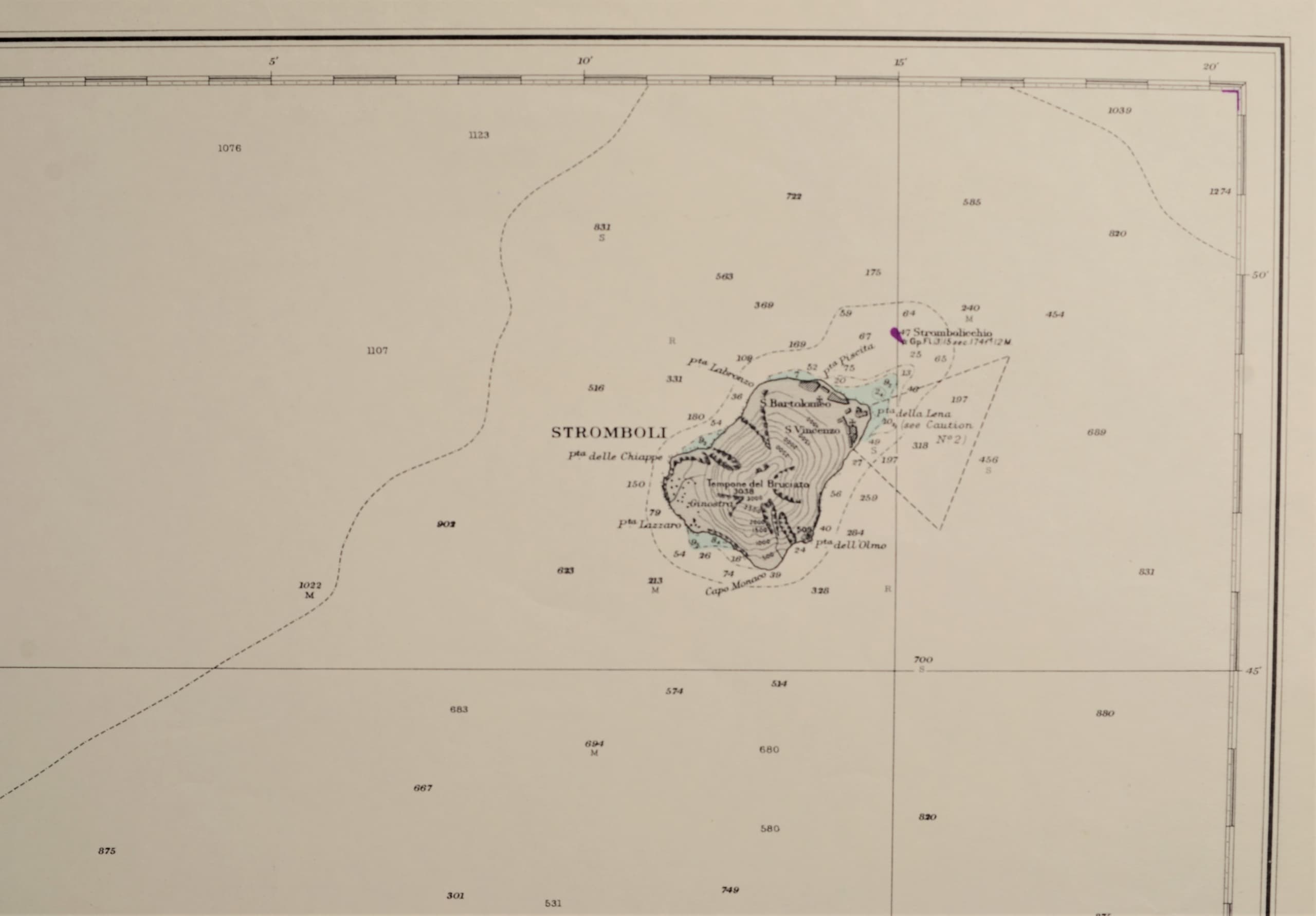
Isole Eolie, Rada di Lipari (issue 1966, edition 1966),
Sicily East Coast, Porto di Augusta (issue, 1890, edition 1944),
Sicily, sheet 2, Mazzara to Palma (issue 1872, edition 1896),
Sicily, sheet 3,Palma to Catania (issue 1872, edition 1893),
Sicily, sheet 4,Catania to Cefalu(issue 1872, edition 1925),
South Coast of Italy, Policastro (issue 1882, edition 1913),
Adriatic - West Coast,Brindisi (issue 1881, edition 1947),
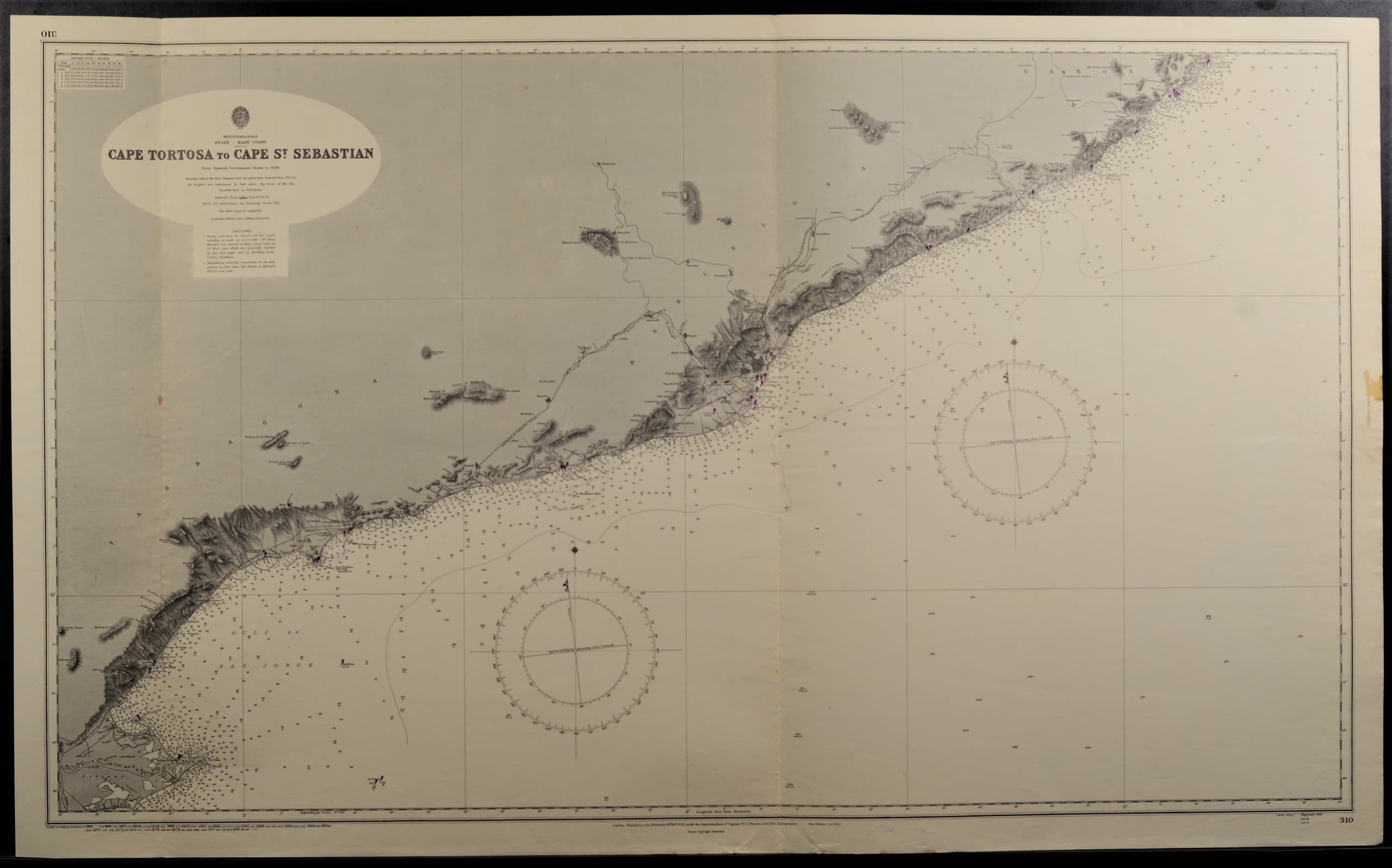
Spain East Coast, Cape Tortosa (issue 1892, edition 1893),
Island of Corsica (issue 1874, edition 1982),
Spain South East Coast, Valencia (issue 1890, edition 1913),
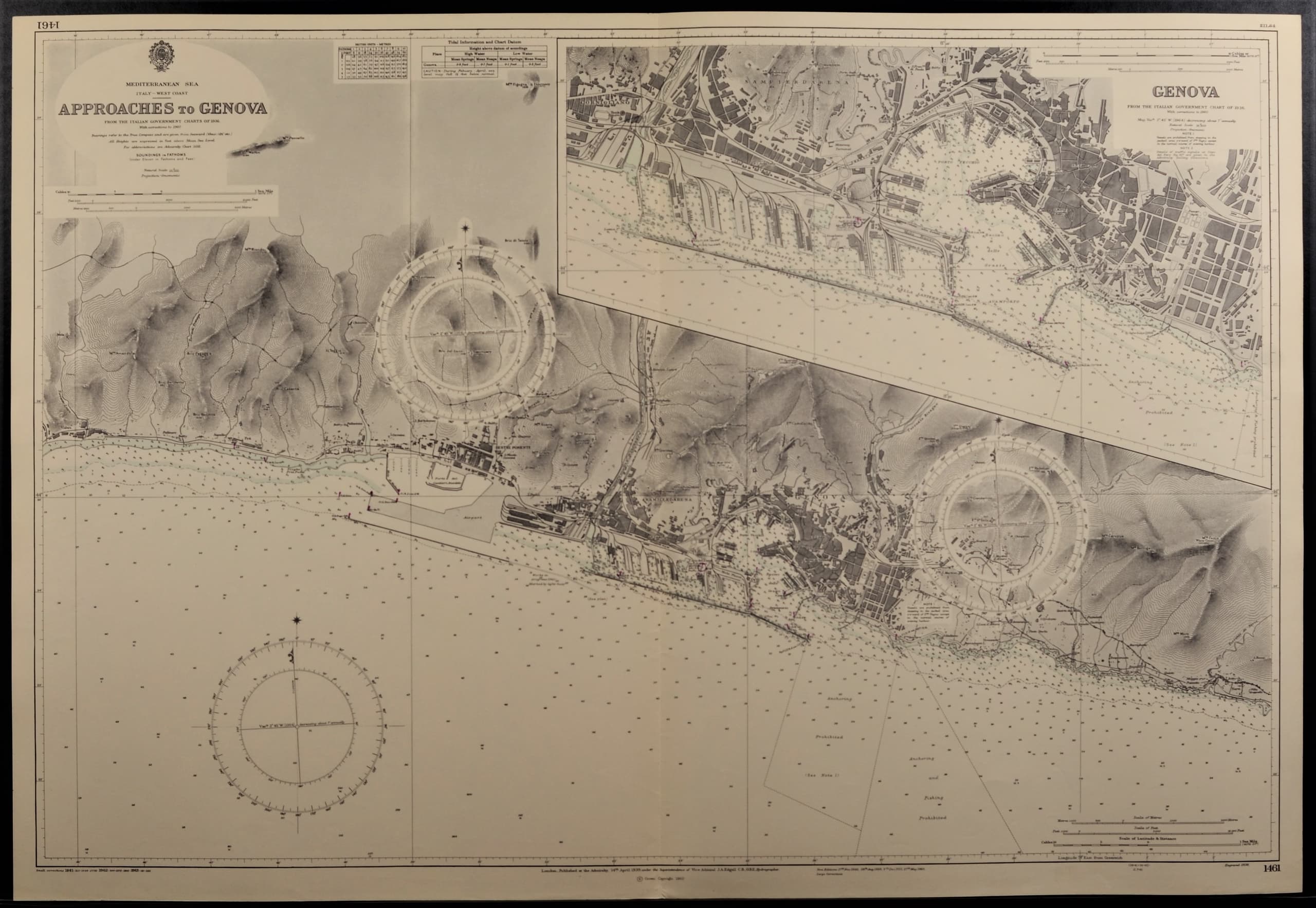
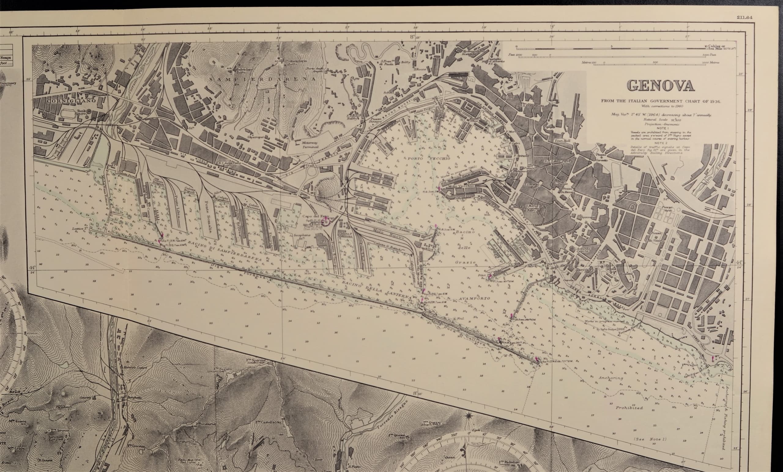
Italy West Coast, Genova (issue 1939, edition 1960),
France South Coast, Marseille (issue 1894, edition 1914),
France South Coast, Marseille (issue 1893 edition 1913),
France - South Coast, Toulon (issue 1893, edition 1913),
France - South Coast, Rade d'Agay (issue 1858, edition 1880),
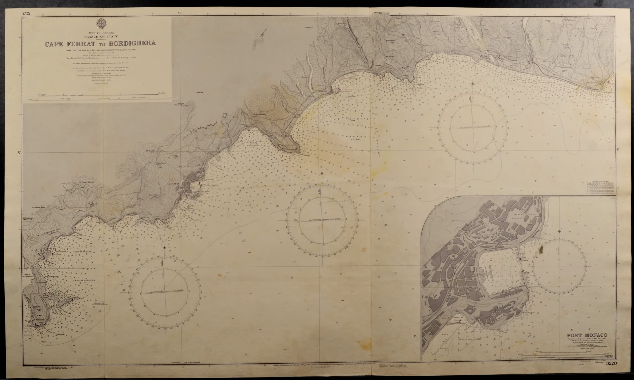
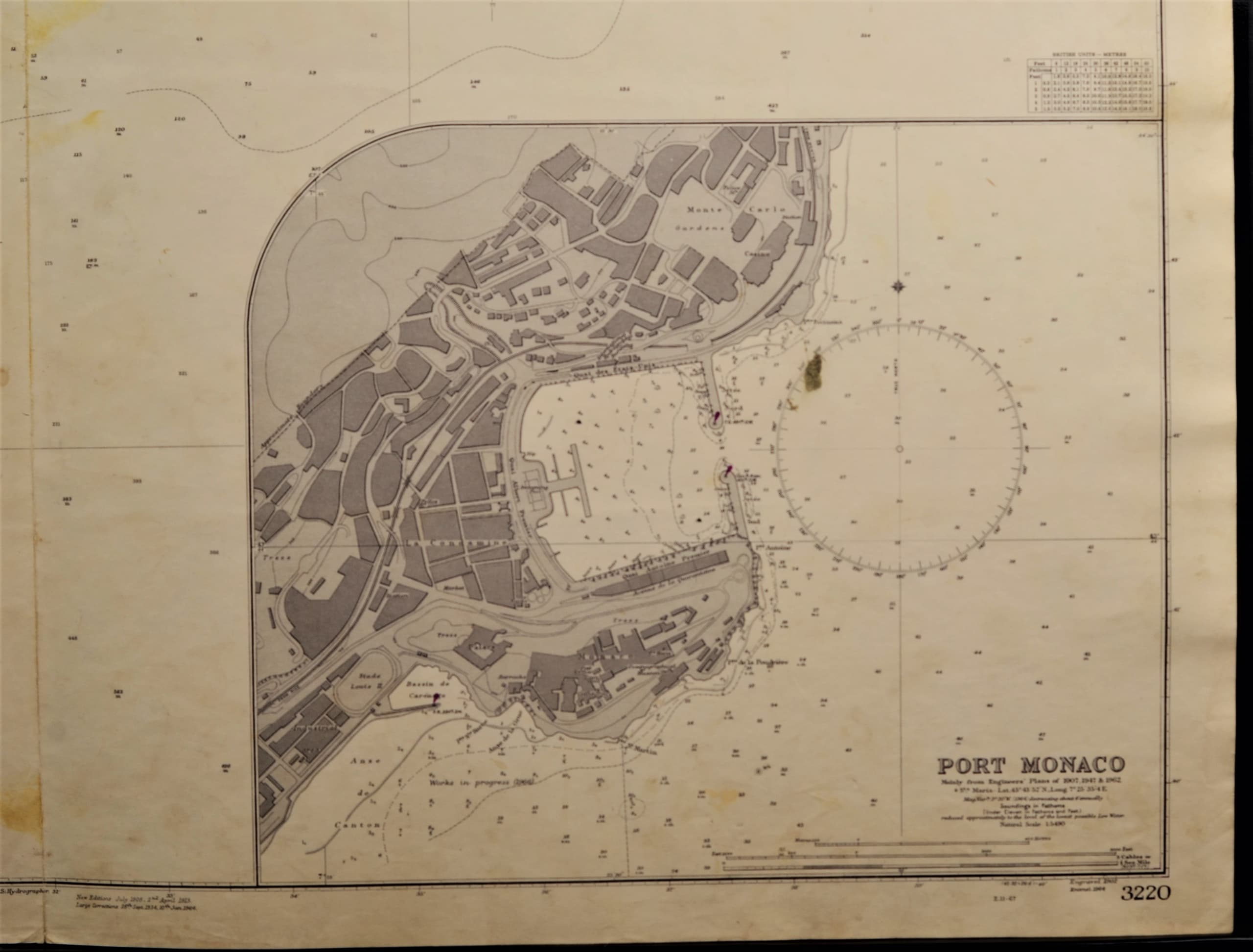
France and Italy, Port Monaco (issue 1902, edition 1913),
France South Coast, Marseille (issue 1904, edition 1913),
Approaches to Strait Gibraltar (issue 1906, edition 1915),
France South Coast, Rade d Agay (issue 1907, edition 1907),
Gulf of Genoa(issue 1944, edition 1944),
Italy, Gulf of Genoa (issue 1944, edition 1968)
Gulf of GenoaPunta san Donato (issue 1944, edition 1944),
Italy NW Coast, Capo di Noli(issue 1944, edition 1944) - provisional WWII,
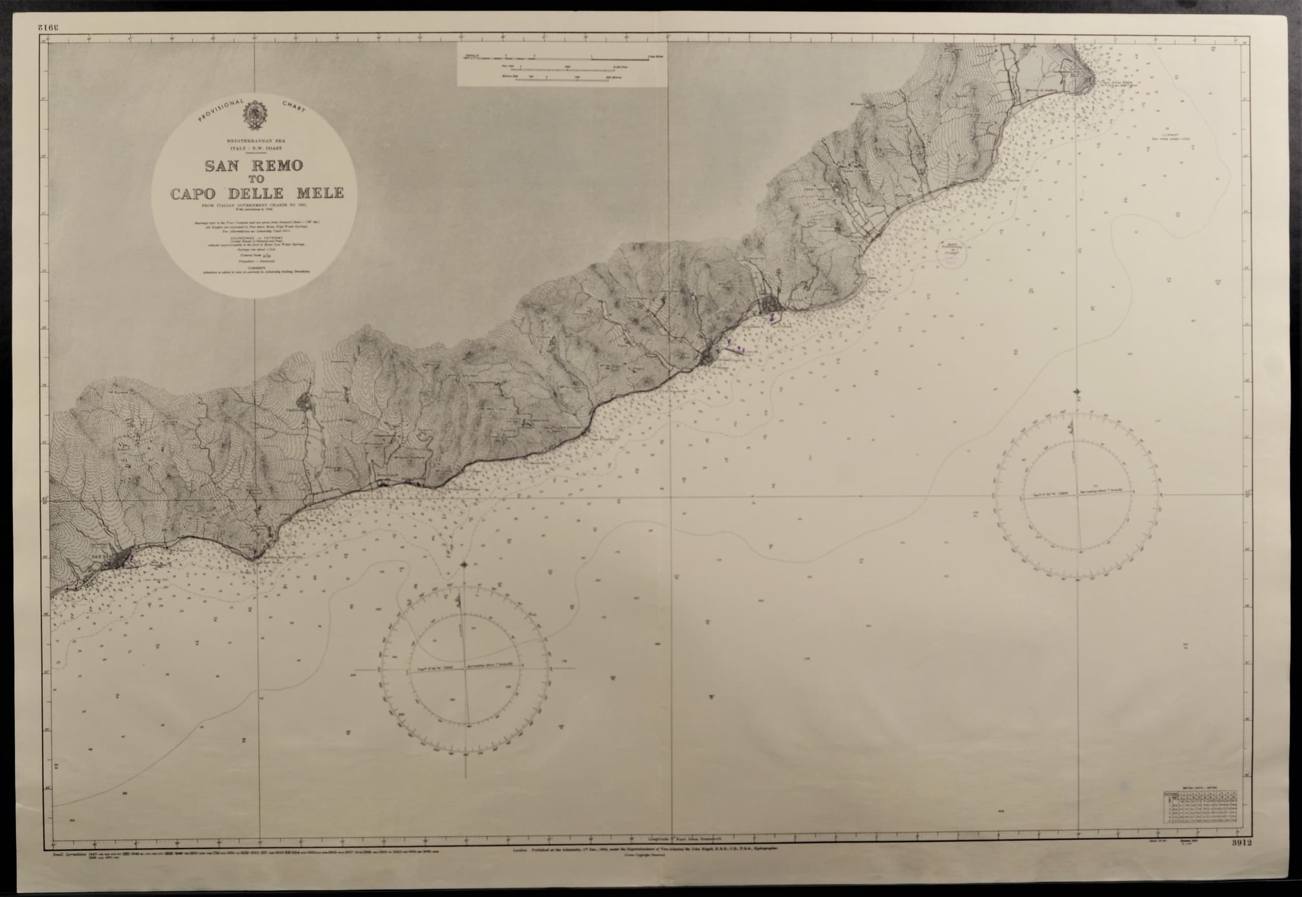
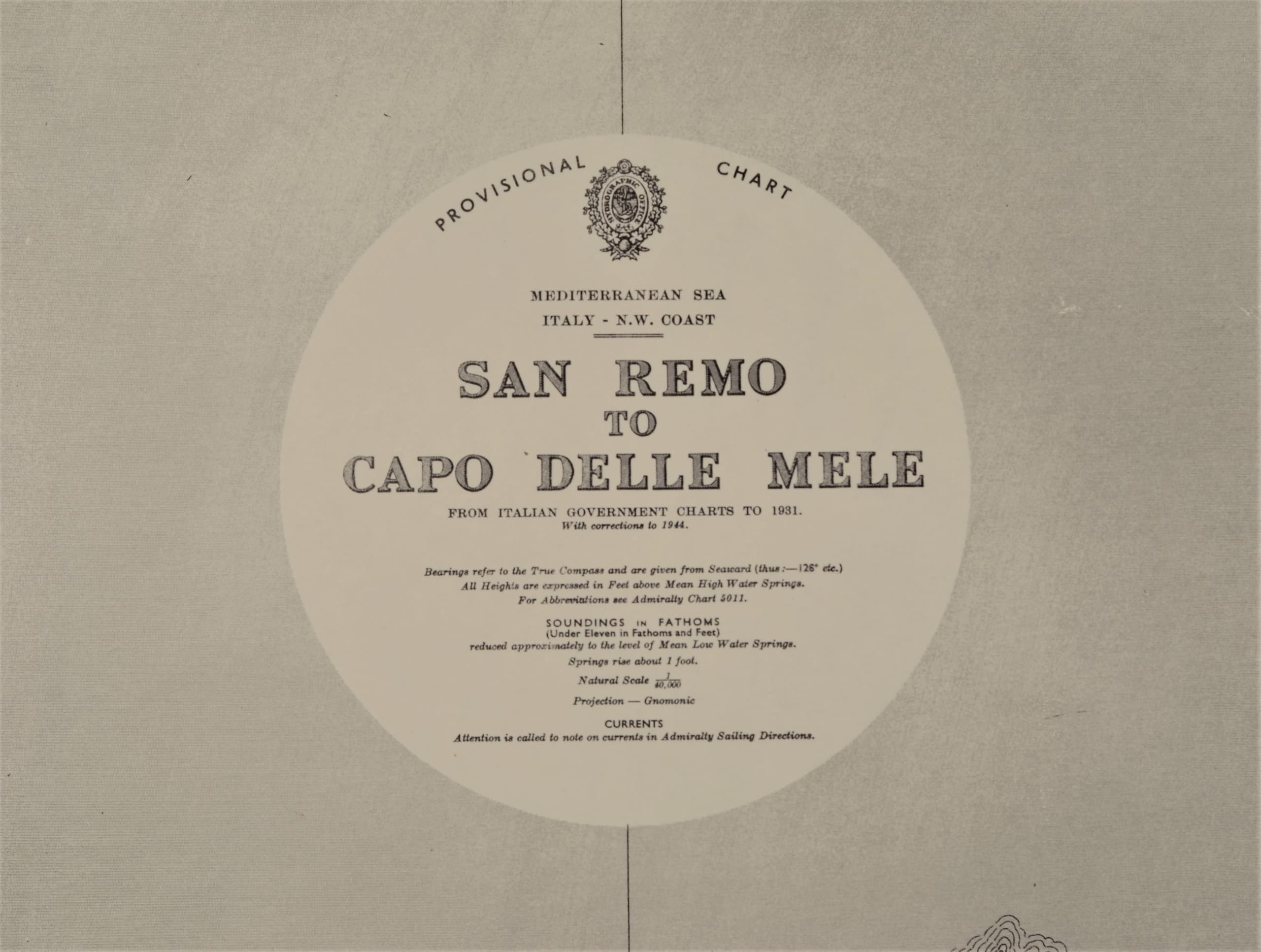
Italy NW Coast, San Remo (issue 1944, edition 1944) - provisional WWII,
Sardinia, Golfo dell Asinara (issue 1944, edition 1944) - provisional WWII,
Sardinia, Canale di San Pietro (issue 1967, edition 1967)
Sardinia, Golfo di Palmas (issue 1944, edition 1944) - provisional WWII
Sardinia, Punta Zari to Punta Zavor (issue 1944, edition 1944) - provisional WWII,
Italy South Coast, Stretto di Messina (issue 1945, edition 1945) - provisional WWII.
Admiralty charts are nautical charts issued by the United Kingdom Hydrographic Office (UKHO) and subject to Crown Copyright.
The Admiralty portfolio offers the widest official coverage of international shipping routes and ports, with various details.
Admiralty charts have been produced by UKHO for over 200 years, with the primary aim of saving and protecting lives at sea. The core market for these charts includes over 40,000 defence and merchant ships globally. Today, their products are used by over 90% of ships trading internationally.