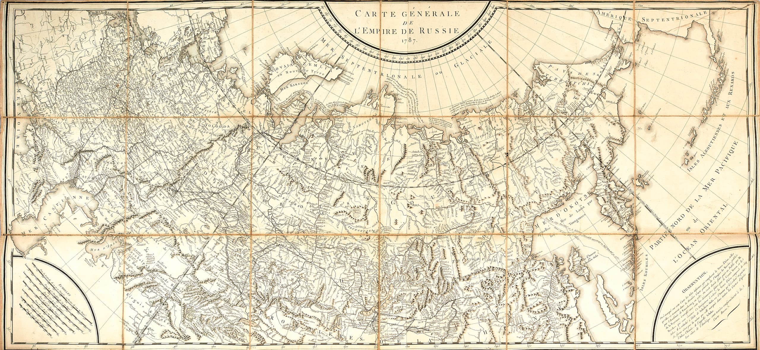
LOUIS GABRIEL SUCHET (1770-1826) General map of the Russian Empire. Engraved by P.F. Tardieu. Paris, 1787.
Lot 7
Sold
Copper engraving
56,2 x 121cm
Glued to a fabric support, foldable format. On the reverse, a paper sticker with the handwritten title of the edition and an ex-libris ‘Le Marechal Suchet Duc d’Albufere’.
The map features the most important communication routes, border posts and fortresses, notes on the exploration of the Northern Sea Route along the coast of the Arctic Ocean, and the route of M. Petushkov’s voyage to the southern islands of the Kuril Ridge in 1777. The Russian Empire’s possessions in the far north-east are shown: the Bering Strait, the north-western tip of Alaska and the Aleutian Islands.
Prepared for the French edition of ‘Voyages of Pallas in Various Provinces of the Russian Empire and Northern Asia’ (Voyage de M.P. Pallas, en differentes provinces de l’Empire de Russie, et dans l’Asie septentrionale. Paris, 1783-1787).
PROVENANCE:
Louis-Gabriel Suchet (1770-1826) – French military leader, Marshal of the Empire (1811), Colonel General of the Imperial Guard Cavalry, Count (1808), then 1st Duke of Albufere (1813), participant in the Revolutionary and Napoleonic Wars.